 |
|
|
AREA INFO
|
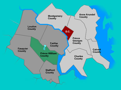
Area InfoPrince William County, Virginia is a superb place to live, work and play and offers a wealth of advantages for businesses including a highly-educated work force, a prime location just minutes from Washington, D.C., thousands of existing businesses, a booming technology sector, and active and supportive Chamber of Commerce and much, much more . . .Geography and Location
Prince William County is
located in Northern Virginia approximately 35 miles southwest of
Washington, DC. It is bounded on the north by Fairfax and Loudoun
Counties, on the east by the Potomac River (Maryland), on the south
by Stafford County and on the west by Fauquier County.
|

ABOUT US | JOIN NOW | NEWS & EVENTS | RESOURCE LINKS | AREA INFO | HOME
8963 Center Street Manassas, VA 20110 8:30 am-5:00 pm M-F P (703) 368-6600 F (703) 368-4733
©2007 Prince William County-Greater Manassas Chamber of Commerce, all rights reserved.
Web Site Design & Hosting by: InterPublishing Group a division of Virginia Systems, Inc.
Email Hosting by: COURE Technologies, Inc.